Reef survey of Pitcairn Island
DISCOVERY Yacht Noxoma
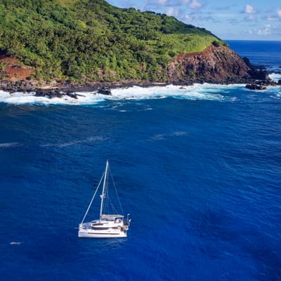
Pitcairn Island, Great Britain
February 15 - 26, 2025
Leadership
Research Team
- Gilles Siu (Marine Biologist/Scientific Diver)
Project Overview
This expedition is part of the Global Coral Reef Monitoring Network’s efforts to collect vital data on coral reefs worldwide. In the region, key contributors—led by the SNO CORAIL / CRIOBE lab in Moorea through the Polynesia Mana program—assess live coral cover down to the genus level, as well as fish abundance and biomass at the species level. Since 2009, water temperature has been continuously recorded, along with wave data, with an interruption in 2020. This long-term data, gathered biennially, is analyzed and shared through regional and global reports, providing policymakers with concrete, science-based insights to guide conservation efforts.
Duration of the Project
1.5 weeks from February 15th-26th, 2025
Expedition Summary
From the 15th to the 26th of February, 2025 The International SeaKeepers Society South Pacific assisted in coral reef monitoring in Pitcairn Island (Great Britain). The most challenging aspect of this expedition was reaching the island. For the research team, securing a suitable vessel is both difficult and costly. Fortunately, the SeaKeepers team identified a DISCOVERY Yacht, DY Noxoma, which was already in Mangareva (French Polynesia) and able to transport the team on the 2.5-day voyage each way.
Upon arrival, deploying the ship’s tender proved difficult due to strong winds at the exposed north-facing site. However, thanks to the captain’s expertise, the divers were able to quickly begin their work. They replaced the temperature logger, which remains in place for two years, and captured 20 permanent photo quadrat images—continuing a long-term time-lapse record of 20m² of reef that has been maintained since 2009. The team then conducted a fish census using the visual survey method along three 50m transects, each 5m wide.
All dives were conducted at a depth of 10m using standard open-circuit dive equipment provided by DY Noxoma. Captain Bruse also acted as the safety diver, assisting when needed. One of the expedition’s most significant tasks was creating a 3D model of a 100m² section of reef using photogrammetry. This involved capturing 2,000 images over a 10m × 10m plot, which were then processed into a digital reconstruction of the reef. This marks the second time such a model has been generated, allowing for a direct comparison of the reef’s condition between 2023 and 2025. An interactive video of this comparison is available at the link below.
Thanks to DY Noxoma, another vital dataset has been added to the long-term monitoring of Pacific coral reefs.
Application
All the data collected is available to the scientific community through the link below.
The data will be used in reports every 5 years regionally and every 10 years globally in an effort to follow what is happening underwater at a broad level.
Locations
Pitcairn Island, Great Britain
You must be logged in to post a comment.